Point · Name · Share
Which one
is that?
Hold your phone up to the hills. Altura names every peak in view, with its height and distance, from the real shape of the ground. Free in your browser, no account.
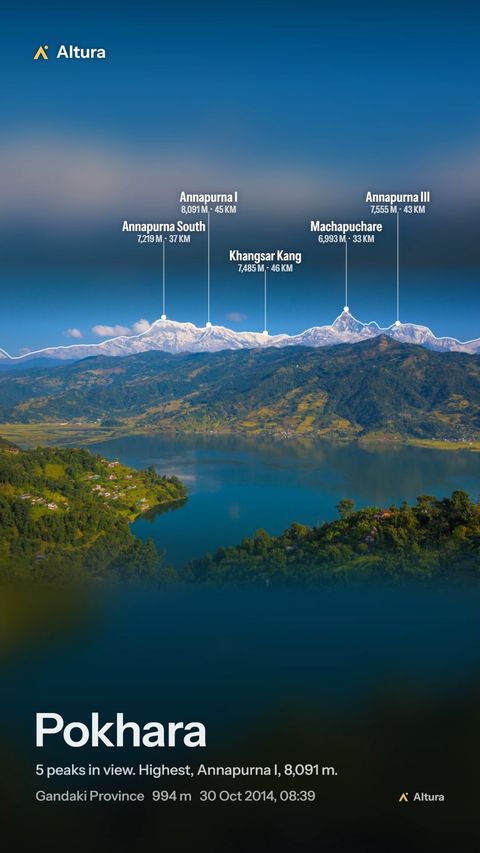
- 1Annapurna South7,219 m
- 2Annapurna I8,091 m
- 3Khangsar Kang7,485 m
- 4Machapuchare6,993 m
- 5Annapurna III7,555 m
A reel made in Altura, Pokhara. Photo: Jmhullot, CC BY 3.0; cropped, names added by Altura.
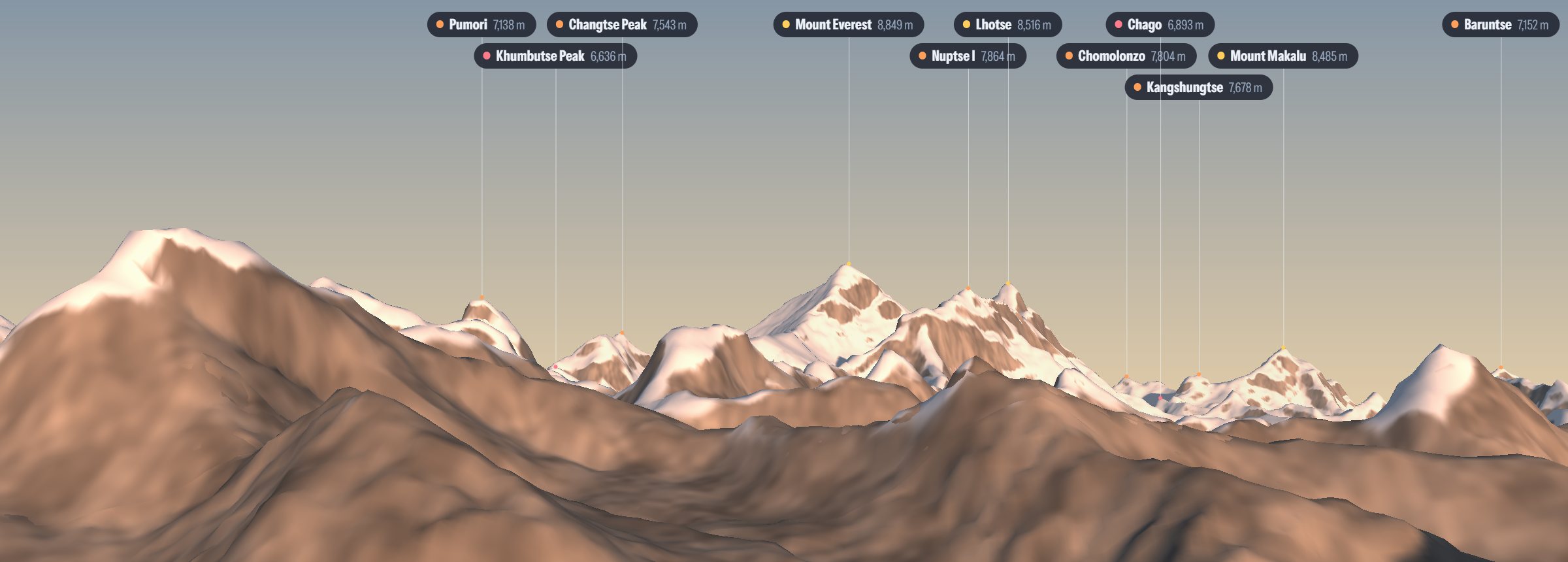
Gokyo Ri · 5,336 m · live 3D
From anywhere, in 3D
Stand on any town, pass or summit in the world and see its view, lit by the real sun at any hour of the day.
- Where
- 24 km east, 3,513 m above you
Tap a peak: the distance, the direction to face, and how much higher it stands than you.
- Can you see it?
- Clearly visible from here
Altura follows the line of sight over the ground in between, allowing for the curve of the earth, so a summit hidden behind a nearer ridge gets no label.
- Alpenglow
- First light 05:55, last light 17:27
When the sun first touches the summit and when it leaves it, often long after your own sunset.
- Will it be out?
- The clearest hours ahead
From the forecast cloud at your spot and around the peak, so you know when to get up for the view.
Made with Altura
One photo, every name
Share a mountain photo to Altura. It works out where you stood and which way you faced, names the peaks, and makes you a reel, a card or a sticker. Or take off and fly round a summit.
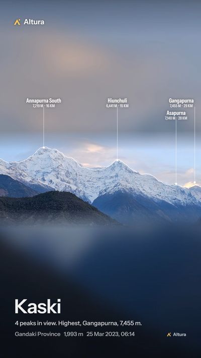
Photo: Nabin K. Sapkota, CC BY-SA 4.0; cropped, names added by Altura.
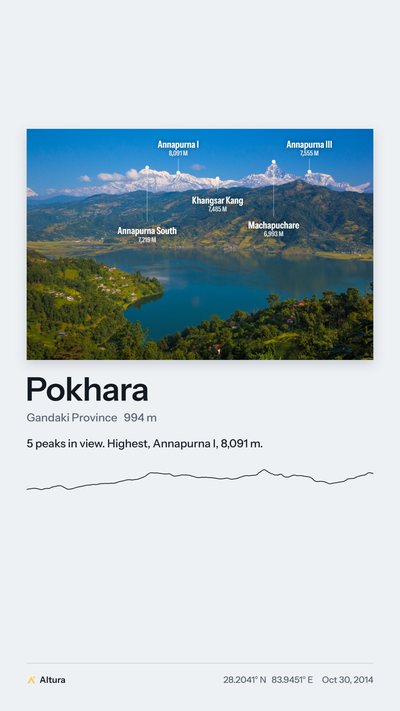
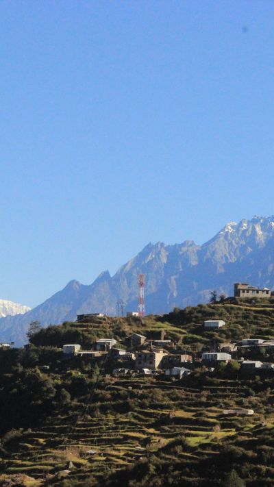
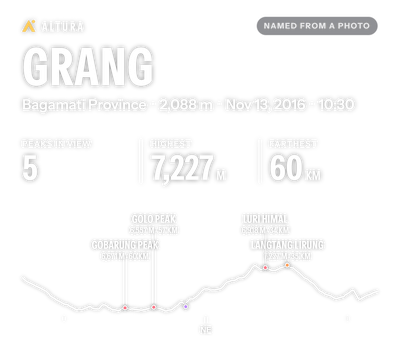
Photo: Rajivkilanashrestha, CC BY-SA 4.0; cropped by Altura.
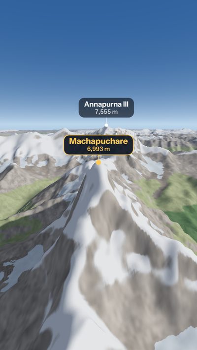
Altura's own 3D: Fly mode from Sarangkot, round Machapuchare.
Where to point it
Viewpoints worth the climb
What you'll see from each one, every peak named, before you walk up.
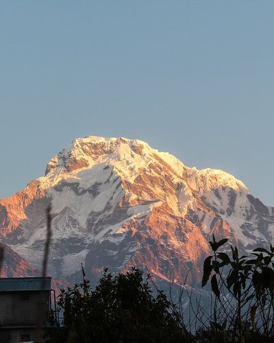
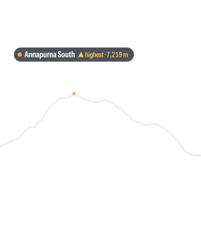
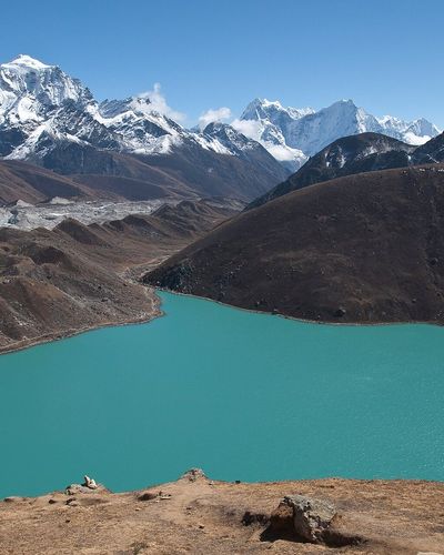
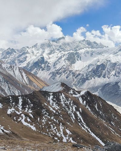
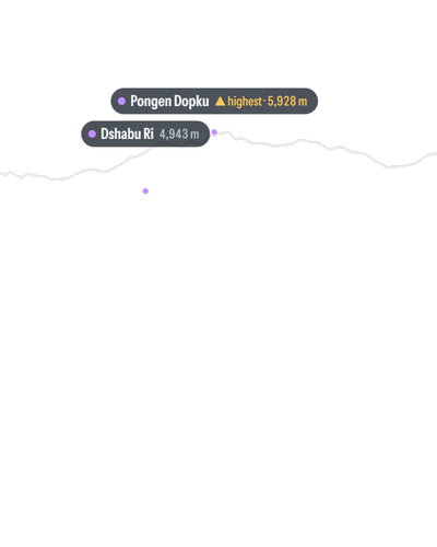
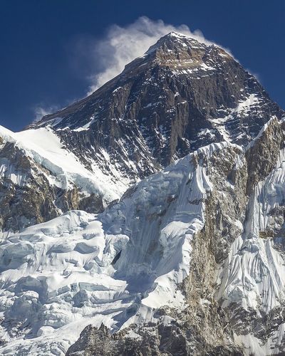


Photos from Wikimedia Commons, cropped; the names on Ghandruk and Kyanjin Ri added by Altura's camera mode: BerryAKC, CC BY-SA 4.0 · Vyacheslav Argenberg, CC BY 4.0 · Deodar16, CC0 · Bijay Chaurasia, CC BY-SA 4.0.
Every viewpoint


On the trail, at home, in a message
Three ways to look
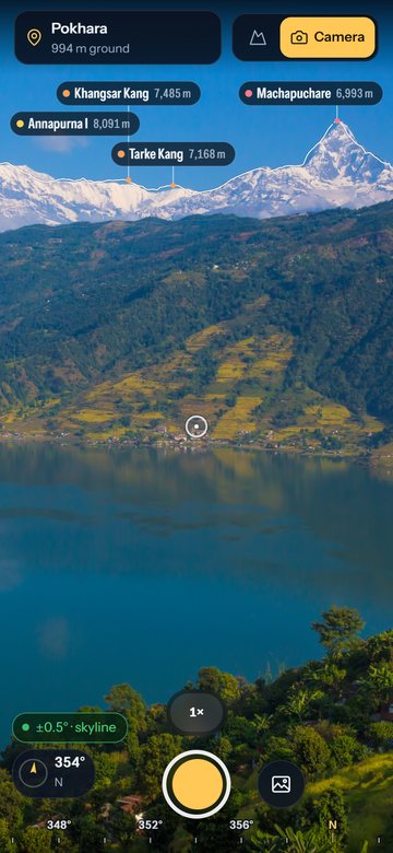
01 / Camera
Through the camera
Hold up your phone. Altura reads the skyline in the picture and lines the names up with it, so they stay on the summits as you turn.
Photo used as the camera: Jmhullot, CC BY 3.0; cropped, names added by Altura.
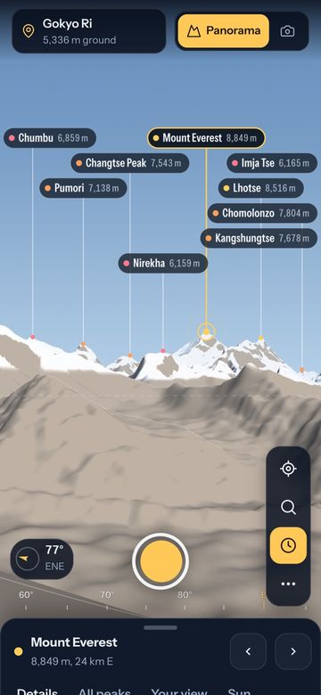
02 / Anywhere in 3D
From anywhere
Pick any town, pass or summit and see what it sees, with the sun where it really is.
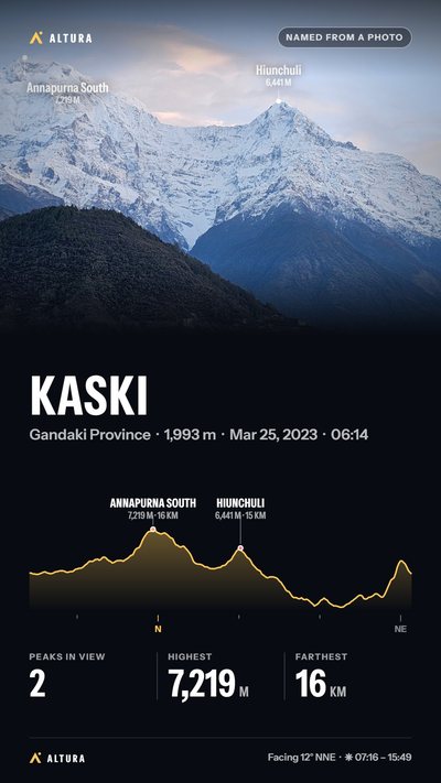
03 / Card or reel
Show someone
Share what you saw as a picture or a short video, with the names, the place and the highest peak in view.
Photo: Nabin K. Sapkota, CC BY-SA 4.0; cropped, names added by Altura.
And the rest of the trip
- Plan
Treks
28 famous treks, from Everest Base Camp and the Annapurna Circuit to the Inca Trail, every day mapped on the real trail. See the treks.
- Plan
Offline areas
Save the terrain and names around a place, or a whole trek, before you go, and it works with no signal.
- Plan
Sun over the real ridges
When the sun clears the mountains and when it drops behind them, not the flat-horizon times.
- See
Fly it like a drone
Lift off from where you stand, fly to any peak and circle its summit, or fly a whole trek, and keep it as a video.
- See
The night sky
Stars, the Milky Way, the Moon and the planets over the peaks, named.
- See
Half a million summits
About 547,000 named peaks from GeoNames and OpenStreetMap ship with Altura, so names appear in a second or two.
- Keep
Name peaks in a photo
Share a mountain photo to Altura and it names what's in it, even when the photo has no location saved.
- Keep
Summit log
The peaks you've seen on location, with levels, badges and the fourteen 8,000-metre peaks to collect.
- Keep
Find one by name
Search for a peak and the view turns to it, with an arrow at the edge of the screen when it's behind you.
No account, no ads, no cookies.
Your camera, photos and summit log stay on your phone. Your location is only sent to fetch the terrain, map, names and forecast for the place you're looking at.
So they can be fixed, errors the app runs into are sent; so is which features you use, unless you turn that off in Settings. Neither says who you are, and nothing is kept on your phone. Two more reports go only if you turn them on. The privacy policy has the details.
Take it with you
Put it on your home screen
Altura installs from the browser like any app: its own icon, full screen, and the places you've opened still there with no signal.
Android
On an Android phone
Or install the web app straight from the browser:
- Open Altura in Chrome.
- Tap Install when Chrome offers it, or open the ⋮ menu and tap Install app.
- Allow the camera and location when you first use them.
iPhone and iPad
On an iPhone or iPad
- Open Altura in Safari.
- Tap the Share button, then Add to Home Screen.
- In camera mode, allow motion and orientation access so the names follow your phone.
Installed, Altura keeps your summit log and offline areas. In a Safari tab, a site you haven't opened for a week loses what it saved.
Computer
On a computer
- Open Altura in Chrome or Edge.
- Click the install icon at the right of the address bar.
- Explore any view in 3D. Camera mode is for phones.
The index
Popular views
In Nepal
- Nagarkot
- Poon Hill
- Kala Patthar
- Gokyo Ri
- Everest Base Camp
- Hotel Everest View
- Tengboche
- Chandragiri
- Dhulikhel
- Phulchowki
- Shivapuri
- Suryabinayak
- Chisapani
- Kalinchowk
- Daman
- Bandipur
- Kyanjin Ri
- Ghandruk
- Australian Camp
- Dhampus
- Mardi Himal View Point
- Annapurna Base Camp
- Khopra Danda
- Mohare Danda
- Pikey Peak
- Thorong La
- Muktinath
- World Peace Pagoda
- Swayambhunath
- Sarangkot
- Nangkartshang
Around the world
Peaks
Today's views
- Nagarkot
- Poon Hill
- Kala Patthar
- Gokyo Ri
- Everest Base Camp
- Hotel Everest View
- Tengboche
- Chandragiri
- Dhulikhel
- Phulchowki
- Shivapuri
- Suryabinayak
- Chisapani
- Kalinchowk
- Daman
- Bandipur
- Kyanjin Ri
- Ghandruk
- Australian Camp
- Dhampus
- Mardi Himal View Point
- Annapurna Base Camp
- Khopra Danda
- Mohare Danda
- Pikey Peak
- Thorong La
- Muktinath
- World Peace Pagoda
- Swayambhunath
- Sarangkot
- Nangkartshang
Treks
- Everest Base Camp trek
- Gokyo Lakes trek
- Everest Three Passes trek
- Annapurna Base Camp trek
- Poon Hill trek
- Mardi Himal trek
- Annapurna Circuit trek
- Annapurna North Base Camp trek
- Manaslu Circuit trek
- Langtang Valley trek
- Upper Mustang trek
- Panch Pokhari trek
- Markha Valley trek
- Goechala trek
- Kilimanjaro, Machame route
- Toubkal trek
- Inca Trail to Machu Picchu
- Salkantay trek
- Torres del Paine W trek
- Laguna de los Tres trek
- Tour du Mont Blanc
- Alta Via 1
- Laugavegur trail
- Mount Fuji, Yoshida trail
- Tongariro Alpine Crossing
- Milford Track
- Half Dome hike
- Grand Canyon Rim to Rim
- Hampta Pass trek
- Druk Path trek
- Kedarkantha trek
- Valley of Flowers trek
- Kanchenjunga Base Camp trek
- Huayhuash Circuit trek
- Tre Cime di Lavaredo loop
- Simien Mountains trek
- Overland Track
- The Jotunheimen Tour
- Kungsleden (Abisko to Nikkaluokta)
- West Highland Way
- Svaneti: Mestia to Ushguli
- Mount Rinjani trek
- Drakensberg Amphitheatre trek
- K2 Base Camp and Concordia trek
- Ala-Kul Lake trek
- Ciudad Perdida (the Lost City)
- Tiger Leaping Gorge High Trail
- Camino Francés: Sarria to Santiago de Compostela
- Chadar Trek: the frozen Zanskar river
- Rwenzori Mountains Central Circuit
- The Walker's Haute Route: Chamonix to Zermatt
- Larapinta Trail
- Torres del Paine O Circuit
- John Muir Trail: Tuolumne Meadows to Red’s Meadow
- Mount Pulag: the Ambangeg Trail
- Huemul Circuit
Guides
- Best time to trek Everest Base Camp: a season-by-season guide
- Everest Base Camp vs Annapurna Base Camp: which is right for you
- Altitude sickness on a Himalayan trek: symptoms and prevention
- Nepal trekking permits explained: TIMS and conservation fees
- What to pack for a Himalayan trek: a stage-by-stage gear list
- Teahouse trekking in Nepal: a night on the trail
- Trekking in Nepal during monsoon: where it still makes sense
- Solo trekking in Nepal: where it's allowed and what changed
- Hiring a guide and porter in Nepal: cost, etiquette and tipping
- Everest Three Passes vs Base Camp: who it's for